
Angus MacKenzie
6 Days Ago
From the ‘Electro-Gyrocator’ system on Honda’s Accord, to the latest GPS systems that integrate with adaptive cruise control and other driver assist features, navigation systems have come a long way in 30 years.

Contributor

Contributor
It seems like an obvious problem. Cars are all about going to places, but how can you get to your destination if you don’t know the way?
The last five decades have seen car manufacturers attempt to solve this problem and improve on trusty street directories and fold-out paper maps with inbuilt navigation systems.
Very early concepts and prototypes made use of a cassette system with pre-recorded routes and verbal instructions, that also connected to the vehicle’s odometer.
The system used a primitive circuit board and a series of beeps to determine the duration before which to play the next instruction, creating a system with surprisingly accurate turn-by-turn directions… as long as you didn’t miss an instruction.
Later systems in production used gyroscopes with physical, interchangeable map ‘slides’ to display the car’s position, while contemporary systems now rely on satellites for far more precise directions.
The latest systems also integrate with other features, including driver assist systems such as adaptive cruise control and, in some cases, even the transmission and headlights.
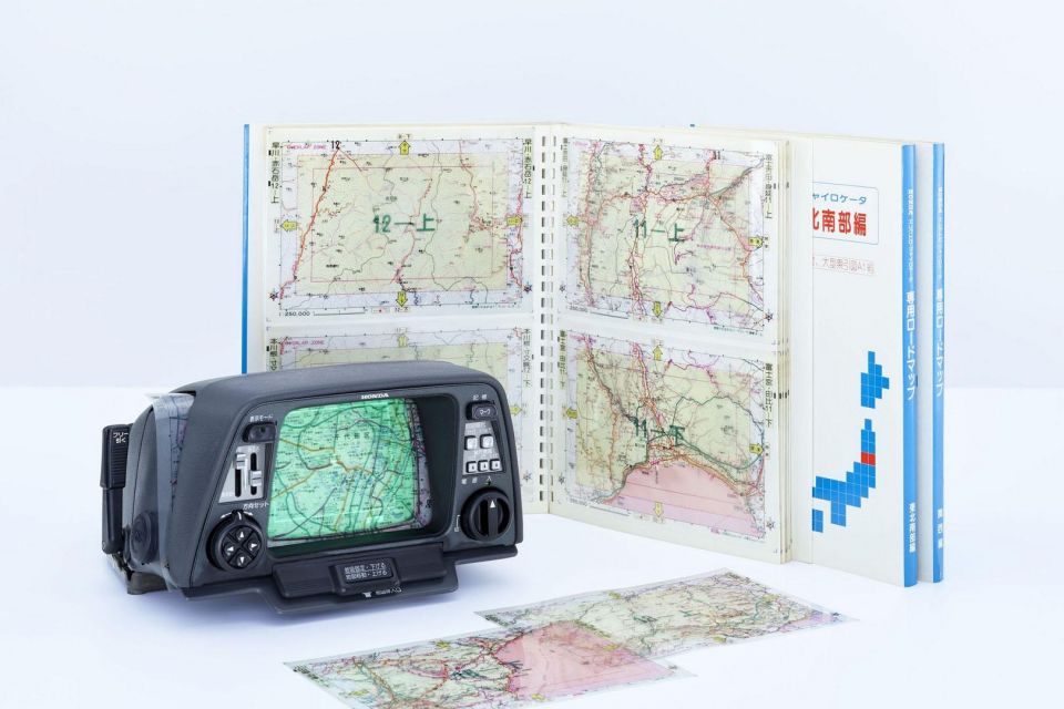
The first commercially-available navigation system was Honda’s Electro-Gyrocator, fitted as a dealer option in August 1981 on the second-generation Accord in Japan.
An inertial system, it used three key components: a helium gyroscope to determine direction, a servo gear connected to the vehicle’s transmission to determine distance covered, and a 6.0-inch CRT display to show the car’s position.
The driver would insert a transparent map sheet over the top of the display (similar in principle to a Nintendo Game & Watch) and the driver could determine the path they need to take. Unfortunately, the system weighed 9kg, and cost almost a quarter of the value of the car itself.
It was discontinued after only a year due to poor sales.
A similar system called Navicom was introduced around the same time by Toyota in the Celica. This also relied on internal components to tell the driver the car’s direction and straight-line distance to a destination whose latitude and longitude had been previously set by the driver.
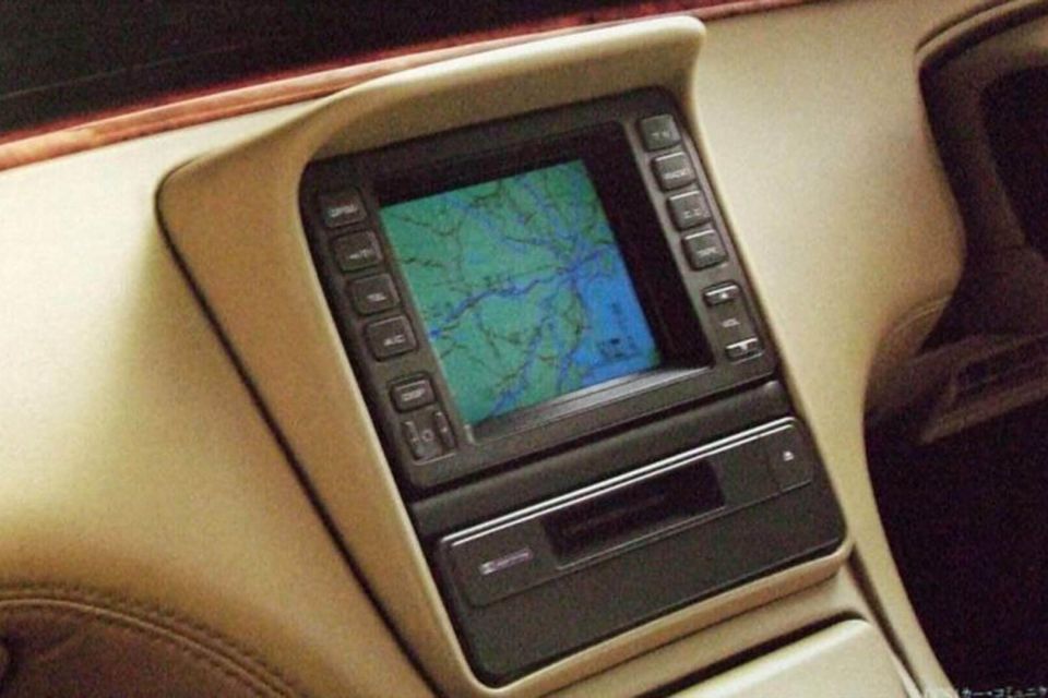
Toyota introduced a navigation system with CD-ROM maps in its Japanese market Crown Royal, but the first vehicle to offer a GPS system was rival Mazda, with its Eunos Cosmo coupé in 1990.
Featuring a colour CRT touch screen, the system used a GPS antenna in the roof of the car, and was able to triangulate the position of the car in real time by receiving signals from these satellites.
Although the maps could zoom, the system took up to nine seconds to perform this function.
Although this early implementation of GPS was accurate only to 50 metres, it’s important to note the US military had only made GPS available for civilian use in 1983, and even then had reduced the accuracy of this version compared to data available for the military.
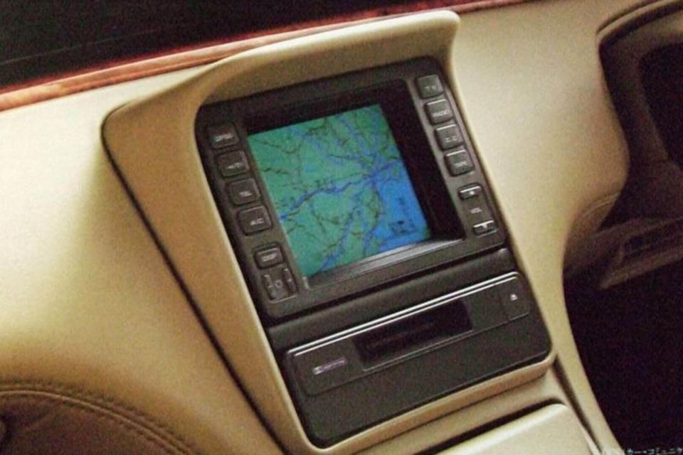
One of the key drawbacks of early systems was processing speed, with the computer having to slowly read data directly from a CD or cassette, and the driver being required to manually change these whenever the car entered a location beyond the map boundaries.
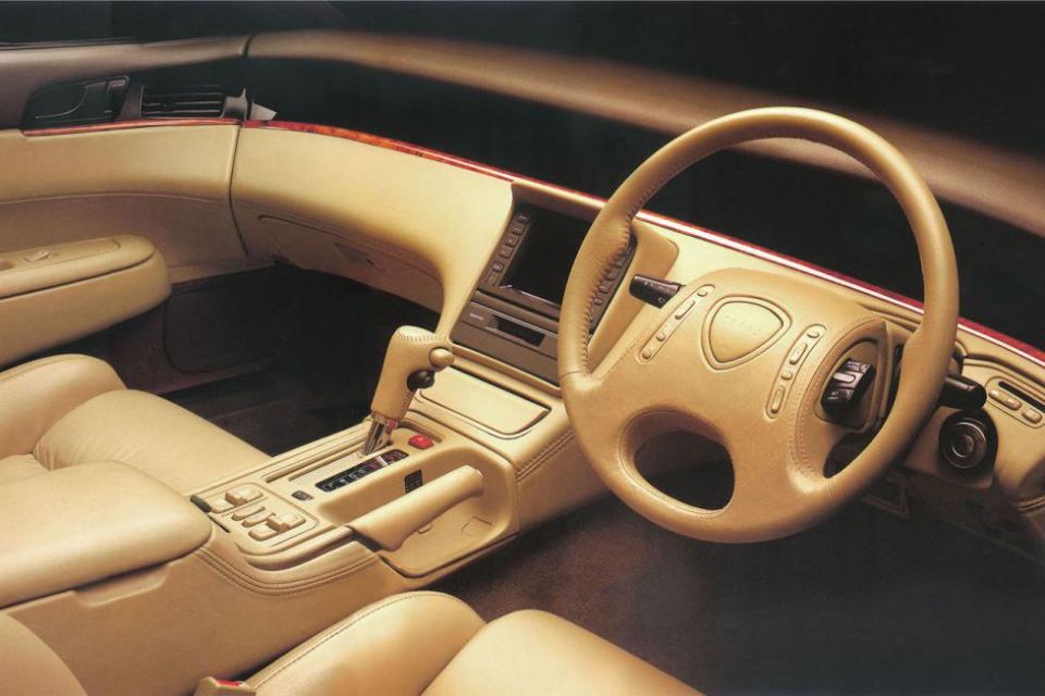
Honda attempted to resolve some of these issues in 1996 with its flagship car, the Legend.
This was the first production car to feature a hard-disk based GPS system, enabling more map data to be stored onboard, with faster processing and without the need to constantly change CDs.
Offered in the USA as the Acura RL, the hard disk was large enough to store map data for all of California before other American regions were added.
DVDs can store more information than CDs, and DVD-based navigation systems were another solution to the storage and processing issues with CD-ROMs. Toyota to debuted this technology in 1998 in the Progres, a domestic-market model that used underpinnings from the Lexus IS.
Google and Apple Maps, and the devices that use them, have maps that remain up to date with the latest streets, points of interest, and other information.
Today, several cars offer GPS systems with similar features, including maps that can display traffic information in real time, and can be updated over-the-air through a 4G or Wi-Fi connection.
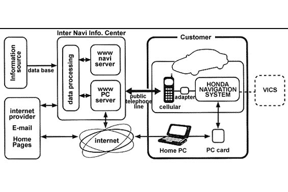
In the Japanese market, this functionality has been available since 1998, with Honda once again pioneering the space through the development of its Internavi vehicle telematics system.
In its original iteration, the ‘two-way’ Internavi allowed the inbuilt navigation system to connect with the Internet via a special adapter that could link the system with the driver’s mobile phone.
It provided real-time information such as weather, updated POIs, map data, or even access to email. Alternatively, the driver was able to create a route on a PC, and then manually transfer this to the car through a special ‘PC card.’
Today’s cars are becoming increasingly digital. Rather than various systems being siloed, convenience and driver assist features can work together to enhance the overall driving experience.
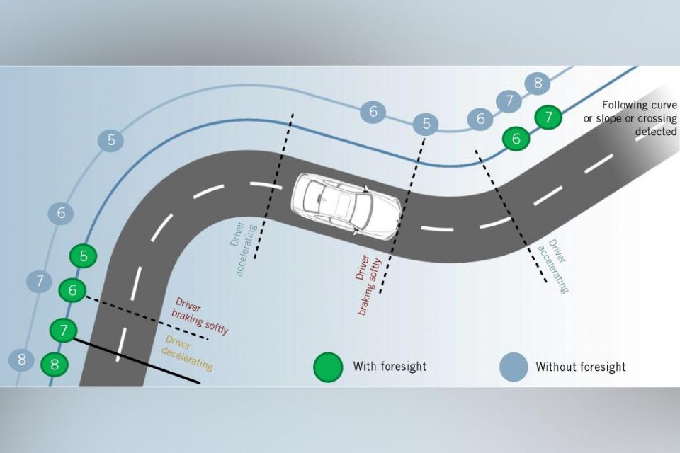
Perhaps one of the most notable innovations here is Volkswagen’s Travel Assist feature. A Level 2 semi-autonomous driver assist system, this combines adaptive cruise control functionality with GPS data, automatically adjusting speed and preparing the car for roundabouts, curves in the road, and junctions.
With the latest S-Class, Mercedes-Benz uses GPS to improve the headlights. Its new Digital Light system is able to use topographical data (such as altitude) to determine changes in geography, such as a steep hill or a downwards slope, and automatically adjust the lighting to ensure the road remains evenly illuminated and the beam ‘hugs’ the road.
Meanwhile, certain BMW and Rolls-Royce models use GPS data to make gearshifts smoother.
Known as a satellite-aided transmission, this system reads map information to determine an upcoming curve or straight road, and automatically pre-select the appropriate gear to provide an even smoother driving experience.


Angus MacKenzie
6 Days Ago

Matt Campbell
5 Days Ago


James Wong
3 Days Ago

William Stopford
2 Days Ago

Max Davies
2 Days Ago

Max Davies
20 Hours Ago